W(e are)here
Mapping The Human Experience
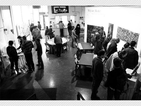
W(e Are )Here was a multi-media exhibit exploring the intersections of communication, technology and aesthetics through data visualization, artistic expression and interactive installation. A related event program gave local and national artists an opportunity to engage a Twin Cities audience.
The exhibition featured over 15 works by 12 local, national, and international artists:
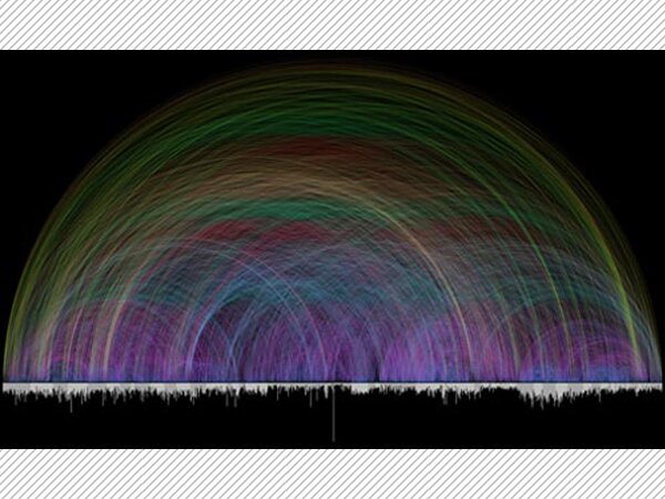
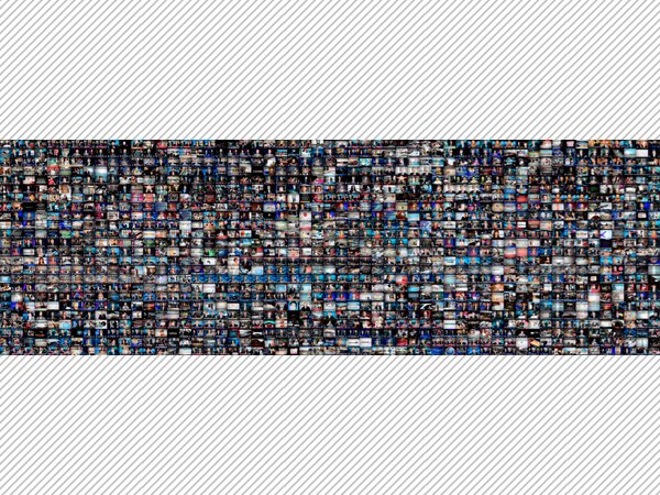
- Christopher Baker
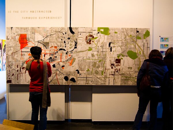
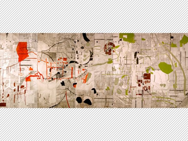
- Twin Cities Knowledge Maps by University of Minnesota's Design Institute
- Karl Frankowski
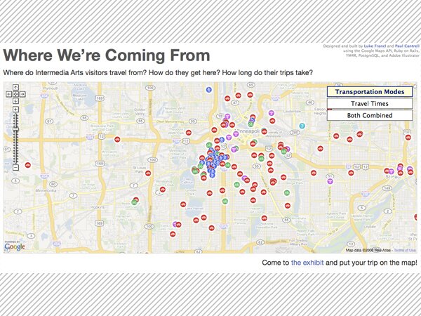
- Where We're Coming From by Paul Cantrell & Luke Francl
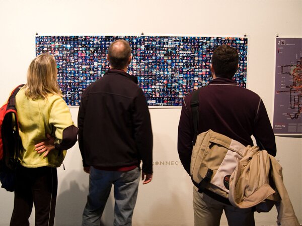
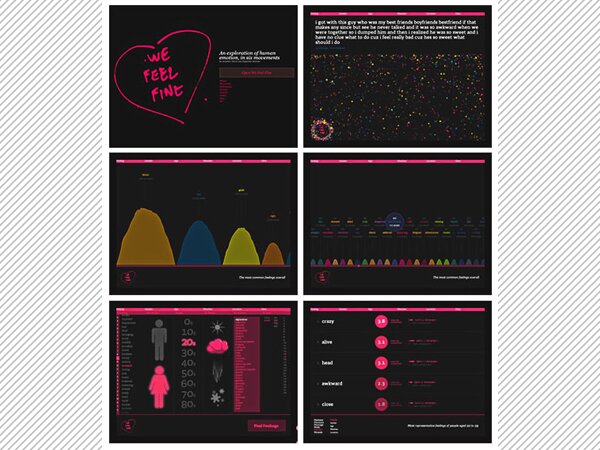
- We Feel Fine by Jonathan Harris & Sep Kamvar
- Stamen Design
- Palisade Head by Scott Nedrelow
- Alice Dodge
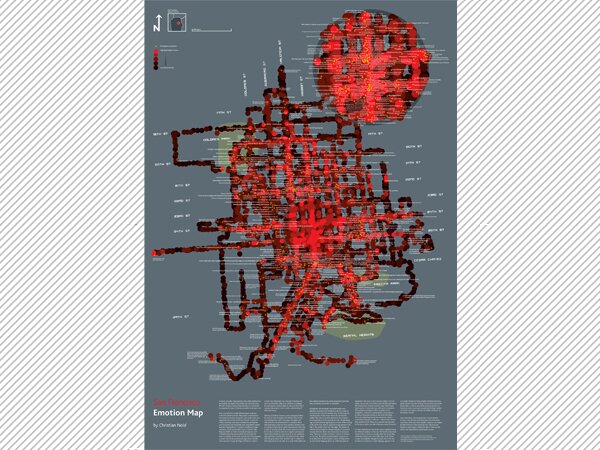
- Christian Nold
- Visualizing the Bible by Chris Harrison
- Selections from WorldMapper
This introduction to the exhibition, written by Brendain Crain, details the ideas behind W(e Are )Here.
During the Age of Discovery, great explorers crisscrossed the planet in search of uncharted territory. They left a visual legacy in the maps that recorded their journeys, and with each new discovery, mankind's knowledge of Earth grew. One can only imagine how thrilling it must have been to live in a world that was seemingly growing larger by the day. The very concept of "where" -- humanity's understanding of our relationship to the world around us -- was expanding.
Today, the internet revolution has democratized exploration in ways that Columbus and Magellan could never have imagined: everyone has become an explorer. New cartographers are adding their personal explorations to existing maps and creating new records of their own experiences. If that which is observed is inherently altered, it follows that a person's experience of a place directly changes the place itself; places are what people believe them to be. That means that today's maps are about much more than hills, valleys, rivers, and roads. Maps have become tools for examining the emotional, sociological, and philosophical aspects of the human experience.
The concept of "where" is changing once again, expanding to include increasingly minute and varied facets of our world. The ever-ephemeral sense of place is created by human interaction with the physical world. Maps have always charted changing systems, but in the internet age the more intense focus on the hyperlocal has sped up the rate at which cartographers work. Slower-moving features of the planet -- shifting continents, growing cities, and eroding shorelines -- have already been adequately mapped; places are now being recorded as they exist for short periods of time. New maps record what could be termed the "hypercurrent."
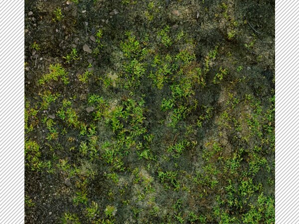
Within this gallery, you will find a sampling of how cartography is being redefined by this change in scale. Whether recording a tiny patch of previously unremarkable forest floor down to the tiniest twig and blade of grass, reorganizing the contents of the Bible to visualize cross-references and social relationships, or taking a fresh look at urban growth by examining the construction date of houses currently on the market, today's cartographers are rethinking how the world around us is recorded and represented to assert the fact that we are here. This new breed of explorer is taking the impersonal maps and graphs of yesterday and making them deeply personal.
Welcome to the New Age of Discovery. Where is expanding: W(e are )here.